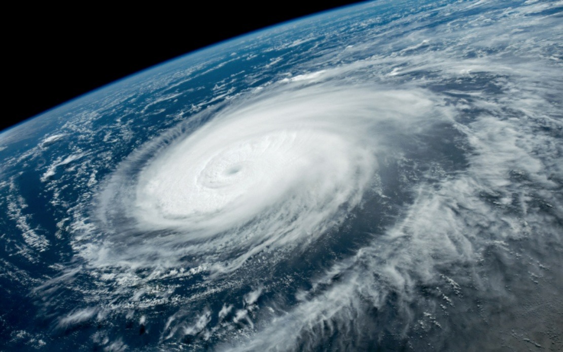
Residents and authorities across China's eastern seaboard are mobilising defences as Typhoon Dolphin edges closer to making landfall. The country's meteorological authority intensified its preparedness stance on Saturday by promoting the typhoon warning from yellow to orange and simultaneously raising the national emergency response classification to Level III, signalling expectations of substantial impact across vulnerable coastal regions.
The cyclonic system is projected to arrive between Sunday night and Monday morning, with landfall anticipated along a stretch of coastline encompassing Zhoushan in Zhejiang Province and Fuding in Fujian Province. This positioning places the storm directly in the path of two of China's most densely populated and economically significant coastal zones, where millions of residents and major industrial operations depend on stable weather conditions and transport infrastructure.
Zhejiang Province, which sits squarely in the typhoon's trajectory, has instituted its second-highest emergency alert level and deployed a monitoring force exceeding 4,000 personnel. These officials have been tasked with inspecting over 7,500 identified areas susceptible to landslides, flooding, and other geological hazards that frequently accompany severe typhoons in this mountainous region. By Friday morning, provincial administrators had executed a comprehensive shutdown of passenger ferry operations across all 162 routes, ordered cessation of work at 193 offshore construction projects, and directed 474 construction vessels back to harbour for safety.
In neighbouring Fujian Province, similar precautionary measures have been implemented with comparable urgency. Ferry operators have suspended 40 passenger routes, while 115 offshore construction sites have halted activities. Particularly significant is the return of all 1,210 registered fishing boats from the coastal city of Fuding to port by Saturday noon—a substantial logistical undertaking that demonstrates the scale of preparation underway. These vessels represent not only significant economic assets but also the livelihoods of thousands of fishermen who depend on operating in the South China Sea.
Shanghai, situated north of the direct impact zone but still within the storm's envelope of influence, issued a blue-level typhoon alert on Friday. Meteorological forecasters have cautioned that Dolphin could subject the metropolis to extended periods of strong winds and heavy precipitation lasting up to four days. Train services throughout the broader Yangtze River Delta region—one of Asia's most important economic corridors—will be suspended starting Sunday, further emphasizing the disruption anticipated across the transport and logistics sectors.
National weather officials have characterised Typhoon Dolphin as potentially more formidable than Typhoon Bavi, which made landfall in China during July. Xu Yinglong, chief forecaster at the National Meteorological Centre, noted that this system may generate stronger wind speeds and deliver heavier rainfall accumulations than its predecessor, suggesting that previous typhoon damage and preparedness plans may need to be reassessed upward. This comparative assessment carries particular weight given that Bavi itself produced significant consequences across affected areas.
China's structured approach to typhoon response reflects institutional experience accumulated over decades of managing tropical cyclones. The nation operates a dual-system framework combining a four-colour weather warning structure—red indicating highest severity, followed by orange, yellow, and blue—with a parallel four-tier emergency response hierarchy in which Level I represents the maximum state of readiness. The current elevation to Level III indicates that while substantial danger is anticipated, officials judge the situation manageable within existing protocols, though still requiring comprehensive mobilisation of resources and personnel.
For Malaysian observers and regional analysts, Typhoon Dolphin demonstrates several relevant dynamics. First, it underscores how tropical cyclone activity in the western Pacific continues to pose significant risks to major Asian economies and population centres, with cascading effects on supply chains and transport networks that extend throughout Southeast Asia. Second, it reflects the substantial investments that developed Asian nations have made in early warning systems, coordinated response mechanisms, and disaster preparedness infrastructure—systems that regional neighbours continue to strengthen. Third, the scale of preemptive action—halting hundreds of vessels and projects simultaneously—illustrates how severe weather events can rapidly disrupt economic activity across multiple sectors, a consideration increasingly relevant as climate patterns shift.
The evacuation and suspension activities now underway across eastern China will impose short-term economic costs through interrupted transport, suspended construction, and fishing boat idle time. However, these measures are designed to prevent loss of life and catastrophic infrastructure damage that would produce far greater longer-term consequences. The thoroughness of preparations, involving ground-based monitors, vessel management, passenger service suspension, and cross-provincial coordination, demonstrates institutional capacity that has been refined through managing numerous previous typhoon seasons.
As Dolphin progresses toward the Chinese coast, meteorological agencies will continue refining forecasts regarding exact landfall location, intensity at impact, and precipitation distribution. These refined projections will enable even more targeted deployment of resources to areas facing greatest danger. For the millions of residents in affected provinces, the heightened alert status serves as both warning and reassurance—warning of genuine hazard ahead, but reassurance that authorities have established comprehensive mechanisms to protect lives and critical infrastructure during the dangerous hours and days to come.

