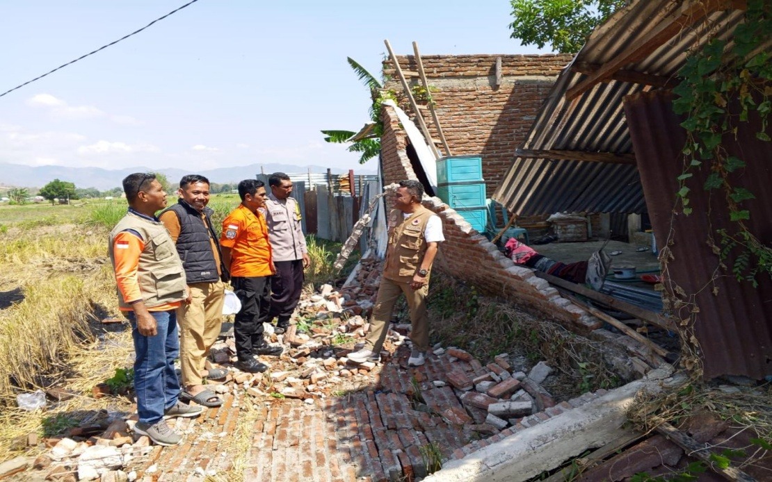
Indonesia's Flores Island faced a catastrophic natural disaster on Saturday when a magnitude 7.7 earthquake struck the region in East Nusa Tenggara province, forcing a substantial emergency response that has displaced thousands and left communities reeling from the initial shock and sustained seismic activity. The tremor, which hit at 4:58 am local time with its epicentre located approximately 30 kilometres offshore near Mbay at a depth of 15 kilometres, prompted immediate evacuation protocols that saw about 2,000 residents moved to safety by authorities, whilst many others independently sought refuge from collapsing structures and the tsunami threat that immediately followed.
The initial disaster alert triggered a tsunami warning from the Meteorology, Climatology and Geophysics Agency (BMKG), which authorities lifted at 7:31 am after monitoring revealed no significant additional sea-level rise. This early warning system proved crucial in preventing potential coastal casualties, though the ground motion and structural damage from the primary quake itself created immediate humanitarian challenges across affected districts. The swift decision to lift the tsunami alert after comprehensive observations allowed residents to shift focus from dual threats to the pressing task of assessing damage and locating casualties in the affected communities.
According to preliminary assessments compiled by the National Disaster Management Agency (BNPB), the earthquake's destructive force manifested across diverse infrastructure and residential areas. Fifty-four houses sustained severe damage whilst nine experienced moderate harm and eleven suffered minor structural compromise. Beyond residential impacts, the tremor damaged five health facilities, one educational institution, three places of worship, one warehouse operated by state logistics agency Bulog, and six government office buildings. These figures, however, represent only initial counts, with BNPB spokesman Berton Suar Pelita Panjaitan emphasising that comprehensive data collection, verification, and validation processes remained ongoing as regional agencies continued ground assessments.
The damage distribution proved uneven across affected districts, reflecting variations in proximity to the epicentre and local building construction standards. Manggarai district emerged as the hardest hit area, recording 29 severely damaged residences alongside nine moderately and nine slightly damaged structures. The adjacent East Manggarai district also suffered substantial losses with 23 houses classified as severely damaged. These concentrations highlight how earthquake impacts vary geographically even within the same regional epicentre, influenced by soil composition, building materials, and local construction practices that differ between Flores's scattered communities.
The death toll reached 20 by Saturday afternoon, with six additional people injured and two others remaining trapped beneath rubble or damaged structures. These casualty figures underscore the human dimension of the disaster, though they remained relatively contained compared to historical precedent for earthquakes of this magnitude, partly attributed to the early morning timing when many residents were indoors and the relatively rapid evacuation response. Search and rescue operations, coordinated through the Maumere Search and Rescue Office, continued prioritising the recovery of trapped individuals whilst simultaneously assisting the displaced population with immediate humanitarian needs.
Beyond physical destruction, the earthquake created cascading complications for regional communications infrastructure. The Communication and Digital Affairs Ministry identified 200 base transceiver station (BTS) sites experiencing disruptions across 10 districts and cities in the East Nusa Tenggara region by 7 am Saturday. Digital Infrastructure director-general Wayan Toni Supriyanto noted that these 200 affected sites represented 16.35 per cent of all BTS infrastructure in the impacted areas, effectively isolating affected communities from essential telecommunications at a moment when emergency coordination and family contact attempts were critical. The ministry coordinated restoration efforts with mobile operators to reinstate services, recognising that communications access directly affects disaster response effectiveness and public safety.
The earthquake generated 111 recorded aftershocks, a frequency that created sustained psychological stress for residents and complicated the work of emergency personnel attempting to assess and respond to damage. Aftershock sequences following powerful earthquakes remain hazardous periods when weakened structures are vulnerable to collapse, forcing evacuation protocols to remain in effect even as initial emergency response shifted toward longer-term recovery planning. The aftershock activity extended beyond Saturday, maintaining elevated seismic hazard conditions that prevented residents from returning to homes and infrastructure personnel from conducting comprehensive damage surveys.
Indonesia's archipelagic geography, situated along the Pacific Ring of Fire where multiple tectonic plate boundaries converge, makes earthquake activity an recurring challenge for regional planning and emergency management. Flores Island's position within this seismically active zone means that residents and authorities routinely prepare for significant tremor events, yet the scale and unpredictability of individual earthquakes continually test response systems. This latest disaster provided a practical evaluation of evacuation protocols, inter-agency coordination, and infrastructure resilience across East Nusa Tenggara's vulnerable communities.
The recovery process for Flores will extend across multiple phases as authorities prioritise search and rescue operations, followed by damage assessment completion, temporary shelter provision, and longer-term reconstruction of damaged homes and public infrastructure. The involvement of regional disaster management agencies, military personnel, police forces, local government administrations, and other supporting organisations demonstrated the comprehensive mobilisation required for effective disaster response at this scale. For Malaysian readers and Southeast Asian observers, the Flores earthquake serves as a sobering reminder of the geological hazards that continue shaping the region's development priorities and the critical importance of robust disaster preparedness frameworks across all island nations in the area.

