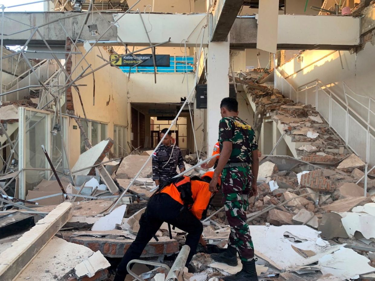
A magnitude 7.7 earthquake struck off the coast of Indonesia's Flores region in the early hours of Saturday, August 15, devastating communities with collapsed buildings and leaving at least two people dead. The powerful tremor, which originated 68 kilometres north-northwest of the city of Ende in East Nusa Tenggara province at a depth of 10 kilometres, sent shockwaves across the island and triggered an immediate response from disaster management authorities, though initial panic about a potential tsunami was later allayed when monitoring agencies determined no dangerous sea-level changes would threaten coastal populations.
Indonesia's Meteorology, Climatology and Geophysics Agency moved quickly to assess the tsunami threat following the 5:58 a.m. local time tremor, which was registered by the U.S. Geological Survey. After careful monitoring of sea conditions, the agency lifted the tsunami warning that had been issued for parts of East Nusa Tenggara, West Nusa Tenggara, South Sulawesi and Southeast Sulawesi provinces. The lifting of the warning represented a critical piece of information for coastal communities, though residents had initially been urged to evacuate beaches and riverbanks and move to higher ground as a precautionary measure.
The earthquake's impact on infrastructure and human life became apparent within hours of the initial shock. The Maumere Search and Rescue Agency reported that at least two residents had lost their lives, while two others sustained injuries in the immediate aftermath. Across the island, the structural damage proved substantial, with numerous buildings and homes reduced to rubble by the powerful shaking. The damage assessment continued as officials and rescue workers moved through affected areas, documenting the extent of destruction and identifying priority areas for assistance.
Hospital facilities across the affected region quickly adapted to emergency conditions, with medical staff evacuating patients from buildings as a protective measure against potential aftershocks. Television footage captured scenes of hospital personnel moving essential medical equipment outdoors, including beds, intravenous stands and oxygen cylinders, establishing makeshift treatment areas in open spaces where staff could continue providing care while minimising risks to patients. These emergency protocols reflected the experience Indonesian healthcare systems have developed through repeated seismic events in this tectonically active region.
Witnesses to the earthquake described scenes of widespread alarm and structural failure across Flores. Yohanna Embu, a resident of Sikka regency in East Nusa Tenggara province, reported observing multiple building collapses, including the waiting room at Maumere's port terminal. She recounted how residents, gripped by panic, fled toward higher ground as the violent shaking continued, a response ingrained by the region's history of deadly seismic events. The strength of the tremor left little doubt among Flores residents about the necessity of immediate evacuation from potentially unsafe structures.
The earthquake proved particularly harrowing at St. Peter Major Seminary in Sikka, where students and nuns attending morning Mass were forced to flee when the roof of an assembly hall began collapsing around them. The Rev. Guidelbertus Tanga, rector of the seminary known locally as Ritapiret Seminary, described the chaotic evacuation beneath the falling structure. In the chaos, at least one priest sustained a broken leg after jumping from the second floor of a building, injuries that underscored the physical dangers posed by the collapsing infrastructure. The seminary, situated on the predominantly Catholic island of Flores, represents one of the region's significant institutional facilities, and damage to such structures carried implications for local communities.
Several powerful aftershocks followed the initial magnitude 7.7 tremor, prolonging the period of uncertainty and danger for residents in affected areas and complicating rescue and recovery efforts. The aftershock sequence, a common feature of major seismic events, meant that damaged structures already weakened by the main shock remained precarious, requiring continued caution from both residents and emergency responders working in the field. Officials maintained heightened alertness as seismic monitoring systems tracked the pattern of aftershock activity.
Indonesia's vulnerability to major earthquakes stems from its geographical position astride the Pacific Ring of Fire, an arc of intense volcanic and seismic activity encircling the Pacific Basin. Situated across more than 17,000 islands, the Indonesian archipelago straddles multiple tectonic plate boundaries where continental and oceanic plates collide, creating conditions for frequent and sometimes devastating earthquakes. This geological reality means that communities throughout Indonesia, particularly those in eastern regions like Flores, must maintain perpetual preparedness for seismic events.
The August 15 earthquake served as a stark reminder of Flores's history of seismic tragedy. In December 1992, a powerful earthquake and subsequent tsunami killed approximately 2,500 people on this same island, one of the deadliest seismic disasters in the region's recent history. That catastrophic event, which claimed thousands of lives and reshaped the island's infrastructure, established a historical benchmark against which residents measure new seismic events. While Saturday's earthquake proved devastating, the lower death toll and the absence of a major tsunami provided some measure of relief compared to the 1992 disaster, though residents remained acutely aware of how quickly circumstances could change during major seismic events.
For Malaysia and other Southeast Asian nations, the Flores earthquake carried implications regarding regional disaster preparedness and international response coordination. The proximity of major seismic zones across the region, particularly along subduction zones and fault lines, means that earthquakes in Indonesia can affect neighbouring countries, particularly those in the maritime domain. The lifting of the tsunami warning, while relieving immediate coastal concerns, underscored the importance of sophisticated monitoring systems and rapid communication protocols that protect populations across national boundaries. Regional cooperation on earthquake monitoring and early warning systems remains essential for protecting the hundreds of millions of people living across Southeast Asia's tectonically active zones.

