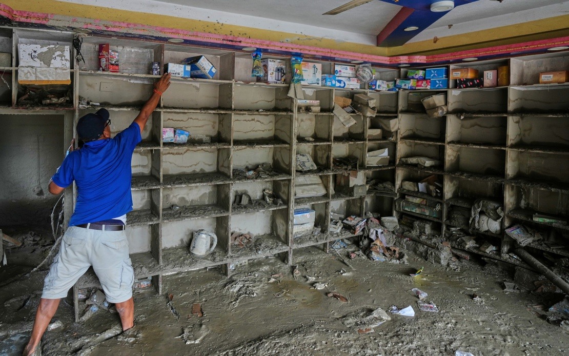
Chinese authorities have determined that a massive avalanche originating from a Nepalese glacier triggered the mudslide that devastated Gyirong Port in southwest Xizang on August 26, underscoring the cross-border environmental hazards that threaten communities across the Himalayan region. Officials revealed on Sunday that the natural disaster, which claimed 16 lives and left 546 people unaccounted for, began when a glacier on the southern face of Mount Langtang Lirung fractured at approximately 5,200 metres elevation in Nepal. The cascade of ice, rock, and debris rapidly descended through multiple ecosystems before transforming into a destructive mudslide that travelled approximately 22 kilometres before striking the Gyirong Port settlement at roughly 1,800 metres altitude.
The progression from glacier failure to devastating mudslide illustrates how climate-related changes in high-altitude ice masses can have far-reaching consequences for populated areas hundreds of kilometres downslope. As the avalanche plummeted from its initial fracture point, it scoured the mountainside and accumulated tremendous volumes of earth and rock, gaining momentum and destructive force with every metre of descent. By the time the debris flow reached Gyirong Port, it had grown into an overwhelming force of nature capable of flattening structures and sweeping away entire communities. The mudslide ultimately destroyed approximately 0.7 square kilometres of developed land, reducing 27 buildings and associated infrastructure to rubble.
The identification of the exact cause represents the outcome of a coordinated scientific investigation conducted by the cryosphere emergency disaster response team from the Institute of Mountain Hazards and Environment, a division of the Chinese Academy of Sciences. Researchers relied on multiple data sources to reconstruct the disaster sequence, combining remote-sensing satellite imagery, field-transmitted monitoring data, and comprehensive on-site investigations to establish the causal chain with confidence. This methodical approach underscores how contemporary disaster forensics employ advanced technology to understand complex mountain hazards and identify their origins, information crucial for developing early warning systems and mitigation strategies.
For Malaysian and Southeast Asian observers, this incident highlights the interconnected nature of environmental risks across the region's mountain ranges. The Himalayan massif and its associated geological systems do not respect national boundaries, and climate-driven changes to glacial systems can produce transnational consequences that demand cooperative approaches to hazard monitoring and response. As global temperatures rise and glaciers worldwide retreat or destabilise, similar cross-border disasters may become more frequent, particularly along river valleys and established travel corridors where human settlements cluster in hazardous proximity to source regions. Nations sharing mountain ranges and their hydrological systems must therefore invest in joint monitoring networks and early-warning infrastructure.
The timing and scale of this disaster also coincide with broader climate patterns affecting high-altitude regions across Asia. Mount Langtang Lirung, situated within the Nepal Himalayas, faces the same warming pressures documented throughout the range, where recent decades have witnessed accelerating glacier retreat and increased instability in ice and permafrost systems. The fracture at 5,200 metres suggests either progressive structural weakening from temperature increases or a sudden thermal or mechanical failure triggered by accumulated stress. Understanding these failure mechanisms becomes increasingly urgent as populations in downstream communities grow and infrastructure development expands into historically marginal areas.
The Gyirong Port area, situated at the terminus of the debris flow's journey, represents one of many vulnerable communities positioned along river valleys that drain glaciated highlands throughout the Himalayas and Hindu Kush ranges. These settlements face inherent exposure to glacier lake outburst floods, debris flows, and avalanches—hazards that become more unpredictable and potentially more severe as climate systems destabilise. For traders and travellers along traditional Himalayan routes, the incident demonstrates the enduring environmental risks that complicate commercial activity and transportation through these regions. The destruction of 27 buildings at Gyirong Port would have disrupted local economic activity and disrupted supply chains linking Nepal and China.
The response by Chinese authorities demonstrates the importance of systematic disaster analysis and scientific investigation in understanding mountain hazards. By documenting precisely how the Nepalese glacier failure produced consequences across an international border, authorities generate knowledge that can inform both immediate rescue operations and long-term planning decisions. The research team's work establishes baseline understanding of how avalanche and mudslide dynamics function across the specific topography of the Langtang valley system, information that contributes to broader scientific knowledge about Himalayan hazard processes. Such investigations also create opportunities for bilateral and multilateral cooperation on shared mountain environments, though such collaboration faces practical and diplomatic obstacles.
Looking forward, the incident raises important questions about preparedness and early-warning capacity in vulnerable Himalayan communities. While modern remote-sensing technology can detect glacier instability and potential failures, the challenge remains translating such data into timely warnings that reach at-risk populations and enable effective evacuation. For Nepal and China, establishing joint monitoring protocols and communication systems for transnational hazards would represent a significant advance in disaster risk reduction. Similar arrangements exist in other regions where shared mountain systems create cross-border risks, though implementation remains inconsistent and often inadequate given the technical complexity and political sensitivities involved.
The tragedy at Gyirong Port serves as a sobering reminder that natural hazards operating across international boundaries require thoughtful, cooperative approaches that transcend typical geopolitical considerations. Southeast Asian nations with mountainous regions and glaciated peaks, though far fewer than Himalayan states, nonetheless face similar challenges in managing transnational environmental risks. Building capacity for hazard monitoring, establishing effective communication channels between neighbouring countries, and coordinating research efforts represent critical investments in regional resilience. As climate change continues reshaping mountain environments throughout Asia, the imperative for such cooperation will only intensify, making the Gyirong Port disaster a potential catalyst for strengthening international frameworks for shared mountain management.

