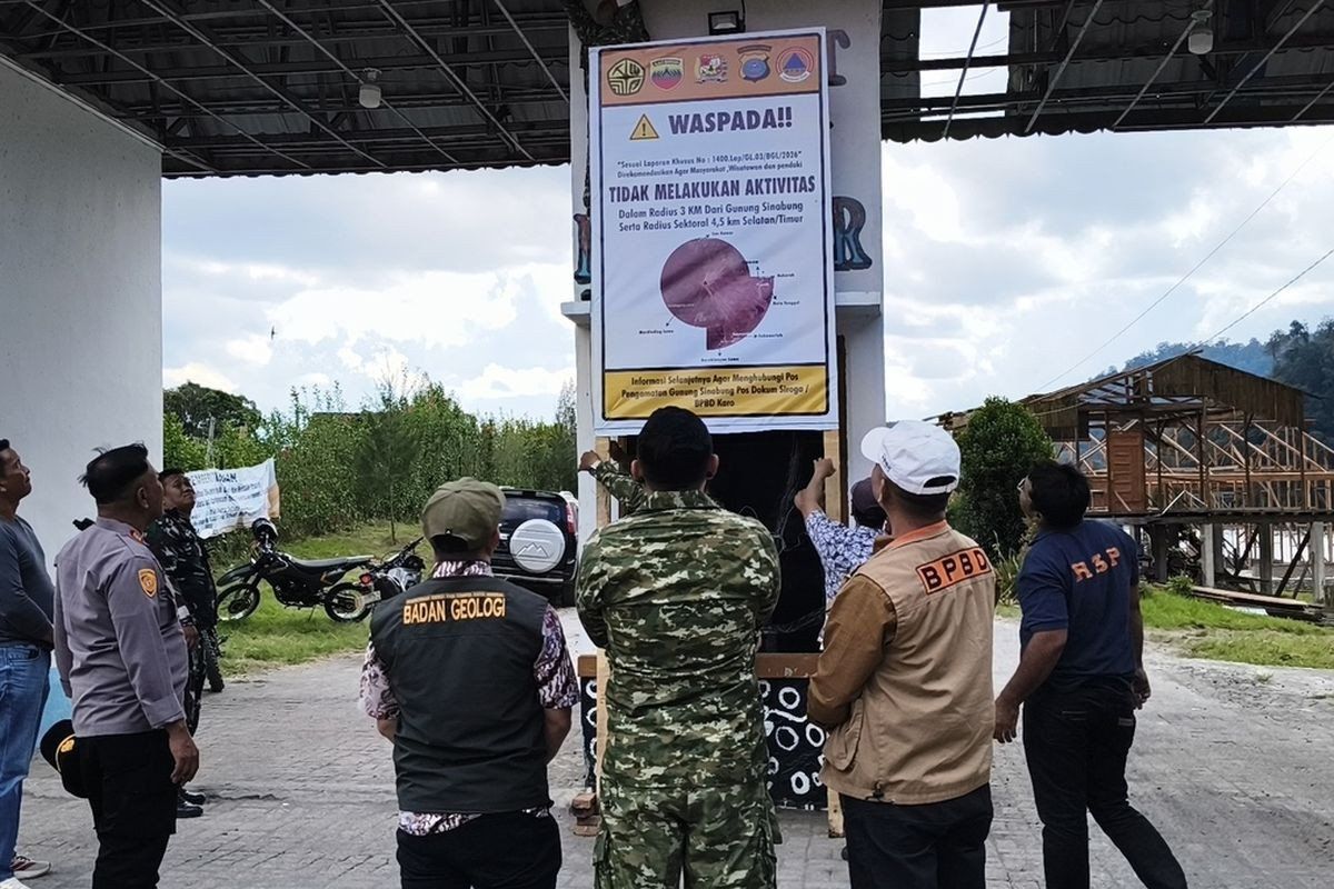
Authorities in North Sumatra's Karo regency have imposed an indefinite closure of Lau Kawar Lake and a camping facility in Kuta Gugung village following a sharp escalation in volcanic unrest at Mount Sinabung. The decision, announced by Karo Youth Affairs, Sports and Tourism Agency head Juni Antomi Kemit, took effect from August 19 and followed direct recommendations from the nation's Vulcanology and Geological Disaster Mitigation Center.
The volcanic activity at Mount Sinabung has intensified noticeably over recent days, prompting officials to upgrade the alert level from Level I Normal to Level II Waspada, which indicates an advisory status in Indonesia's four-tier alert classification system. Armen Putra, head of Mount Sinabung's monitoring post, confirmed the escalation and outlined specific safety zones established by the government. Residents and visitors are now advised to maintain a distance of at least three kilometres from the summit, with an expanded exclusion zone of 4.5 kilometres extending toward the south-east sector where volcanic hazards pose the greatest risk.
The monitoring data reveals concerning signs of volcanic unrest. As of early Thursday morning, seismographs recorded five volcanic earthquakes occurring within Mount Sinabung, accompanied by additional tectonic tremors. This represents a marked increase from the previous day, when instruments detected only one volcanic quake alongside seven tectonic events. Officials have cautioned that the rising frequency of seismic activity correlates directly with an elevated likelihood of eruption, underscoring the gravity of current conditions. Visual observations confirm thick plumes of smoke rising between 100 and 800 metres above the volcano's summit, a telltale indicator of magma movement and degassing within the chamber below.
The threat extends beyond those near the summit. Communities situated along riverbanks fed by streams originating on Mount Sinabung face particular danger from potential lahars—devastating mudflows composed of volcanic material, water, and debris that can travel vast distances downslope at dangerous speeds. Authorities issued formal recommendations on August 13 urging residents in vulnerable areas to remain vigilant and prepared to evacuate if necessary, with Juni's statement on August 26 emphasising that the temporary closure of Lau Kawar Lake represents a precautionary approach designed to safeguard both local communities and tourists.
Mount Sinabung's history illustrates why such caution is warranted. The 2,460-metre volcano had remained dormant for approximately 400 years before making a dramatic return on August 29, 2010. That inaugural eruption in the modern era proved relatively modest, with activity declining by September. However, the volcano's behaviour became far more erratic and dangerous over the following years. A fresh eruption commenced on September 15, 2013, before subsiding nine days later. A catastrophic major eruption struck in November 2013, escalating the alert status to Level IV Awas, the highest designation. That explosion unleashed pyroclastic flows—superheated avalanches of gas, ash, and rock that travel at tremendous velocity—which claimed dozens of lives across surrounding villages. The disaster forced the evacuation of thousands of residents from 21 villages and two hamlets, demonstrating the volcano's capacity to inflict mass casualties and displacement across an extensive area.
What followed was nearly a decade of continuous volcanic restlessness. Mount Sinabung maintained an elevated threat level throughout 2013, 2014, and beyond, requiring sustained monitoring and periodic emergency management. The volcano's status was eventually downgraded to Level III Siaga (watch status) on May 20, 2019, after volcanologists analysed both visual observations and instrumental data confirming that the immediate threat had measurably diminished. Yet this reprieve proved temporary. On July 28, 2021, Mount Sinabung erupted anew, shooting volcanic ash to altitudes of 4,500 metres and ejecting pyroclastic flows as far as 1,000 metres toward the east-southeast. At least five districts experienced significant impact, with thick blankets of ash blanketing the landscape across a wide region.
That 2021 eruption stands as the most recent major activity, following 11 years of intermittent volcanic manifestations. The sheer unpredictability and destructive potential demonstrated by these events underscores why officials take current warning signs with absolute seriousness. Each escalation in seismic activity, each increase in gas emissions, and each rise in ash plumes represents a potential harbinger of major eruption, making precautionary measures economically justified despite their impact on regional tourism and livelihoods.
The closure of Lau Kawar Lake and affiliated recreational facilities reflects Indonesia's increasingly sophisticated approach to volcanic disaster risk management. Rather than awaiting catastrophic eruption, authorities now implement graduated responses calibrated to early warning signals. This strategy, refined through bitter experience and informed by modern volcanological science, prioritises public safety whilst avoiding unnecessary economic disruption during false alarms. For Malaysian travellers and tourism operators who have increasingly ventured to North Sumatra in recent years, the closure underscores the importance of monitoring official volcanic alerts before planning visits to this geologically active region.
The implications extend beyond immediate tourism disruption. Mount Sinabung sits within a broader volcanic arc encompassing Indonesia, the Philippines, and parts of Southeast Asia, all positioned along the Pacific Ring of Fire. Understanding how Indonesian authorities manage volcanic hazards offers instructive lessons for Malaysia's own volcanic regions and for the broader region's preparedness frameworks. As climate change potentially influences precipitation patterns and volcano-climate interactions, sustained vigilance at major volcanic centres like Mount Sinabung remains essential for protecting both regional communities and the international visitors who increasingly explore Indonesia's remarkable but hazardous natural landscape.

