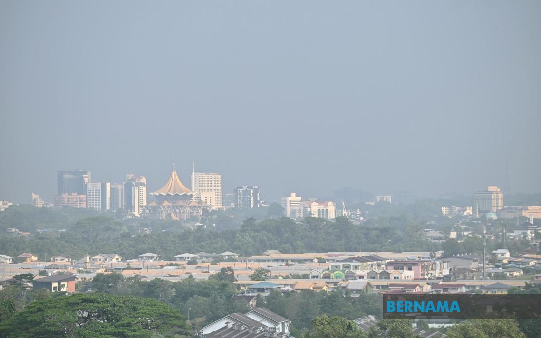
Malaysia's meteorological authority has issued an extended weather alert for Sarawak, warning that a heat wave accompanied by dry conditions will persist through August 20, creating mounting concern about regional air quality and visibility hazards. The Malaysian Meteorological Department released the forecast on Wednesday, cautioning that the atmospheric pattern, driven by southerly wind systems combined with an unusually high concentration of active hotspots across Borneo, will sustain the oppressive conditions for at least another week.
The implications of this prolonged dry spell extend beyond mere discomfort. Southern Sarawak faces the greatest vulnerability to deteriorating visibility and haze formation as the combination of elevated temperatures and low moisture persists. The mechanisms at play involve the movement of smoke and particulates from land-clearing fires and agricultural burning, which becomes trapped in the lower atmosphere when air circulation patterns favour stagnation. This weather configuration is particularly problematic during the latter half of August, when atmospheric dynamics typically shift, but current projections suggest the southerly flows will maintain their dominance.
Evidence of the mounting air quality crisis is already visible in real-time monitoring data. By mid-morning on Wednesday, ten locations across Malaysia had registered Air Pollutant Index readings climbing into the unhealthy category, with the overwhelming majority concentrated in Sarawak. This spatial distribution underscores the regional nature of the problem—whilst other parts of the peninsula experience more favourable conditions, Borneo's geography and prevailing wind patterns have made it a focal point for air pollution accumulation during this period.
The hotspot situation deserves particular attention from environmental and disaster management authorities. The sustained elevation in active fire detections across Borneo indicates that land-use conversion, agricultural expansion, or deliberate burning practices remain intensive. These sources feed directly into the haze formation process, meaning that until burning pressures ease or weather patterns shift to dispersive wind regimes, air quality will likely remain compromised. For Sarawak's population and economy, this creates a multi-week health and visibility management challenge.
The timing of this forecast carries additional weight for regional planning. August is typically a shoulder month between distinct monsoon seasons in Southeast Asia, and the persistence of these conditions into late August suggests the normal seasonal transition may be delayed. Meteorological departments across the region are closely monitoring whether the current pattern will dissolve as expected or whether anomalous conditions might extend further, a matter of significant concern given the potential knock-on effects for the broader maritime and aviation sectors dependent on clear visibility standards.
MetMalaysia's simultaneous issuance of thunderstorm and heavy rainfall warnings for northwestern Peninsular Malaysia and the Klang Valley region illustrates the complexity of the current atmospheric setup. Whilst Sarawak languishes under persistent heat and stagnant air, the western side of the peninsula faces convective activity driven by moisture convergence and afternoon heating. This dichotomy reflects the distinct weather systems operating across Malaysia's disparate regions—a reality that complicates unified public health messaging about air quality and weather preparedness.
For the affected areas on the peninsula, the thunderstorm warnings covering all of Perlis, Kedah, Penang and Kuala Lumpur, together with targeted zones in Perak including Kerian, Selama, Larut Matang, Manjung and Bagan Datuk, plus Selangor districts from Sabak Bernam through Hulu Selangor, carry implications for infrastructure stability, electrical systems, and surface transportation. The convergence of warnings until early afternoon Wednesday indicated that the convective systems were still developing, with residents in those corridors needing to remain weather-aware throughout the day.
The public response mechanisms mobilized by MetMalaysia reflect a broader ecosystem of climate communication that has evolved considerably in Malaysia. Beyond traditional warning systems, the agency now operates across multiple digital channels—its official website, various social media platforms, and the myCuaca smartphone application—recognizing that diverse population segments access information through different pathways. This multi-channel approach is particularly important for vulnerable groups who may lack consistent internet access but can receive alerts through broadcast or community mechanisms.
For businesses, agricultural operations, and public health planners in Sarawak, the August 20 deadline marks a critical juncture. Understanding the precise timing of forecast improvements allows them to schedule sensitive outdoor operations, medical supply planning for air quality-related respiratory complaints, and resource allocation accordingly. School administrators, transportation authorities, and event organizers will similarly benefit from clarity about when current conditions are expected to relent.
The broader regional context matters considerably. Sarawak's experience with haze is embedded in a longer history of transboundary pollution events affecting Malaysia, Singapore, Brunei, and Indonesia. When Borneo experiences elevated burning and stagnant atmospheric conditions, the consequences ripple across borders. This latest episode, whilst localized to Sarawak at present, serves as a reminder of the region's shared meteorological destiny and the importance of coordinated air quality monitoring and cross-border information exchange.
Looking ahead, the critical question for environmental authorities and urban planners involves whether August 20 will bring relief or merely mark a pause in an extended dry season. Climate variability means forecasts carry inherent uncertainty, particularly beyond ten days. Sarawak's residents and institutions should treat the current advisory as definitive guidance through mid-month whilst remaining prepared to adapt if atmospheric patterns prove more stubborn than anticipated. Maintaining vigilance through the myCuaca app and official channels will provide the most current updates as conditions evolve.

