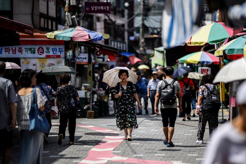
South Korea is experiencing unprecedented heat conditions, with the southeastern city of Yangsan recording a nation-high temperature of 41.4 degrees Celsius on Friday afternoon, according to the Korea Meteorological Administration. The reading, logged at 1:40 p.m. local time, marks the most extreme temperature capture since the KMA began systematic weather observations using modern ASOS technology in 1973. This breakthrough surpasses the previous national record of 41.0 degrees Celsius, which had stood since August 2018 when it was recorded in Hongcheon.
The magnitude of this heat event becomes clearer when examining the pattern of extreme temperatures across the affected regions. Yangsan has now endured three consecutive days during which temperatures climbed above the 40-degree Celsius threshold, reflecting the relentless nature of the current heatwave. The extended duration of such severe heat at these levels underscores how this episode differs from brief temperature spikes, instead resembling the kind of sustained weather phenomenon that leaves lasting impacts on public infrastructure, agriculture, and public health systems.
The meteorological administration has responded with its most severe alert protocols in place. The highest-level heatwave warning remains active for parts of South Gyeongsang Province, particularly affecting Yangsan and surrounding districts. Beyond these hotspots, heatwave advisories and warnings continue across virtually all of South Korea, signalling that the dangerous conditions are not isolated to one region but constitute a nationwide crisis affecting millions of people from the mountains of the north to the industrial zones of the south.
The underlying atmospheric mechanism driving this extreme event involves a rare convergence of high-pressure systems that have effectively sealed the Korean Peninsula under an oppressive blanket of hot air. The simultaneous influence of the North Pacific High and the Tibetan High has created a meteorological scenario comparable to placing a lid over the region, according to KMA explanations. This dual pressure system prevents typical weather circulation patterns from allowing cooler air masses to penetrate southward, while simultaneously limiting cloud formation that would normally provide temporary relief through shade and evaporative cooling.
For Malaysian and Southeast Asian observers, this event carries relevance beyond mere meteorological curiosity. Regional climate patterns increasingly show signs of intensifying heat episodes, with many tropical and subtropical areas already pushing toward the physiological limits of human tolerance. South Korea's record, while geographically distant, demonstrates how even temperate regions are experiencing climate extremes previously considered rare or impossible. This should prompt reflection on whether similar pressure systems could concentrate over Southeast Asia, where temperatures are already higher and populations often less accustomed to extreme heat mitigation strategies.
The practical consequences of sustained 40-plus degree temperatures in an advanced economy like South Korea are severe and multifaceted. Power grids face unprecedented demand for air conditioning, elderly populations confined to homes become vulnerable to heat stroke, outdoor workers—including construction and agricultural labourers—must navigate dangerous conditions, and transportation infrastructure itself becomes stressed as materials expand and efficiency declines. These challenges become exponentially more acute in developing nations with less robust cooling infrastructure and populations with higher exposure to outdoor work.
Meteorologists are also tracking Typhoon Dolphin, which is currently positioned in the western Pacific and may influence weather systems affecting the Korean Peninsula in the coming week. While the eventual trajectory and impact of this typhoon remain uncertain, the convergence of a potential tropical weather system with the existing heatwave creates a complex forecasting challenge. The typhoon could potentially disrupt the pressure systems currently trapping heat, or it could instead enhance moisture levels while maintaining high temperatures, creating dangerous combinations of heat and humidity.
The KMA's meticulous record-keeping over five decades provides an objective baseline against which to measure the severity of current conditions. By anchoring this event to consistent observational standards implemented since 1973, the administration has created an irrefutable record that cannot be dismissed as measurement anomaly or observational error. When such consistently measured records are broken, the implications for climate trends become impossible to ignore, particularly when previous records themselves were recent occurrences.
For regional policymakers and public health officials, South Korea's current heatwave offers both cautionary lessons and practical insights. The country's response—deploying maximum-level warnings, coordinating across provinces, and mobilizing public communication systems—represents a model that could inform preparations elsewhere in East and Southeast Asia. However, it also illustrates the limitations of response systems when atmospheric conditions become this severe; advance warning and coordination can mitigate but cannot eliminate the dangers posed by sustained extreme heat.
Looking forward, the trajectory of this heatwave will depend substantially on whether the blocking high-pressure systems persist, whether Typhoon Dolphin's track diverts these systems, and whether cooler air masses can eventually penetrate from higher latitudes. Meteorological services across the region will be monitoring developments closely, as the patterns emerging in South Korea may presage similar conditions in adjacent regions. For Malaysian observers accustomed to consistently hot and humid conditions, the concern is less about absolute temperature than about the breakdown of normal weather variability and the potential for extreme weather clustering—multiple severe events in rapid succession.

