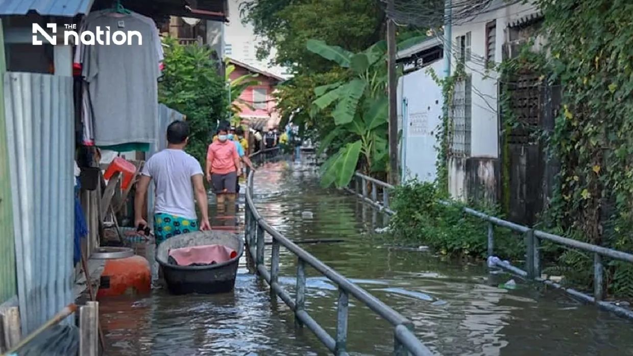
Thailand's disaster management authorities have activated alert procedures across Bangkok and six surrounding central provinces following forecasts of elevated sea levels that could trigger widespread flooding in vulnerable riverside communities. The Department of Disaster Prevention and Mitigation (DDPM) issued the warning on Saturday afternoon, triggering a cascade of notifications to local authorities, business operators, and residents across the affected zones. The high-tide phenomenon is anticipated to persist from Monday, July 13, through Sunday, July 19, with peak water levels occurring during evening hours between 6pm and 10pm each day during this critical week.
The geographic scope of the alert encompasses Pathum Thani, Nonthaburi, Nakhon Pathom, Samut Sakhon, Samut Songkhram, and Samut Prakan provinces, all of which form the immediate periphery of Bangkok. Within these provinces, specific districts have been flagged as particularly vulnerable, including Mueang Pathum Thani and Sam Khok in Pathum Thani; Mueang Nonthaburi, Pak Kret, and Bang Kruai in Nonthaburi; and four districts across Samut Prakan province. Samut Songkhram, the smallest and lowest-lying of the affected provinces, faces exposure throughout all its districts. These areas are particularly susceptible due to their proximity to the Chao Phraya River and extensive canal networks that drain into the Gulf of Thailand.
Theerapat Kachamat, the DDPM's director-general, explained that the warning derives from official data supplied by the Royal Thai Navy's Hydrographic Department, which monitors sea-level fluctuations and tidal patterns across Thai waters. The Navy's assessments specifically reference conditions around Phra Chulachomklao Fort on the Chao Phraya River, a key measurement point for understanding water dynamics in Bangkok and its surrounding region. Such coordination between civilian disaster agencies and naval technical expertise reflects Thailand's established protocols for managing water-related hazards that regularly affect densely populated lowland areas.
The mechanics of this particular flooding risk involve the interaction between elevated seawater and freshwater systems. During high-tide periods, seawater backs up into the Chao Phraya River and connected waterways, impeding the normal downstream flow of rainwater and canal discharge. This hydraulic bottleneck causes water levels to rise across interconnected river and canal systems, particularly affecting areas with minimal elevation above sea level. Communities situated outside formal flood barriers or lacking permanent defensive infrastructure face the highest exposure. The anticipated overflow threatens not only individual residences but also agricultural zones, small commercial establishments, and informal settlements that characterise much of the riverside landscape in central Thailand.
Local governments have received explicit instructions to disseminate timing information to all relevant stakeholders well before each high-tide cycle. Business operators managing floating restaurants, riverside warehouses, and water-transport services require advance notice to adjust operations and secure assets. Residents in affected communities need sufficient warning to implement household-level precautions, including moving essential items to elevated areas and preparing temporary relocation if necessary. The DDPM's directive emphasises continuous monitoring rather than panic, recognising that this represents a predictable, recurring phenomenon rather than an unpredicted catastrophe.
Private sector entities engaged in construction projects along riverbanks face particular scrutiny during this alert period. Ongoing flood-defence infrastructure development, temporary work platforms, and equipment positioning all require careful management when water levels fluctuate dramatically. Contractors and engineers must coordinate with disaster authorities to ensure their activities neither exacerbate flooding risks nor create additional hazards for workers or the public. The alert essentially creates a temporary framework within which industrial activity adjacent to water systems must operate with heightened caution.
For Malaysian and Southeast Asian observers, this Thai alert underscores the persistent vulnerability of low-elevation urban and suburban zones throughout the region to tidal and hydrological pressures. Bangkok's situation mirrors challenges faced by coastal and delta regions across the region, from Malaysia's Klang Valley to Vietnam's Mekong Delta. As climate patterns shift and urban sprawl extends into increasingly marginal terrain, the frequency and severity of such water-management crises appears to intensify. Thailand's established warning infrastructure and multi-agency coordination mechanisms, while imperfect, represent institutional mechanisms that neighbouring countries reference when developing their own disaster-preparedness frameworks.
The DDPM has implemented multiple communication channels to ensure information reaches vulnerable populations effectively. The dedicated 'THAI DISASTER ALERT' mobile application provides real-time notifications and updates, whilst traditional channels including radio broadcasts and local government announcements remain active. For those experiencing actual flooding or requiring emergency assistance, the 1784 hotline operates continuously with 24-hour staffing, whilst residents can alternatively contact authorities through the LINE messaging platform using the dedicated account @1784DDPM. This technological redundancy reflects recognition that different demographics utilise different communication platforms, necessitating multi-channel outreach.
The Central Disaster Prevention and Mitigation Command (CDPMC), functioning as the coordinating body above the DDPM, has elevated this from a routine advisory to a formal alert status, signifying the importance authorities attach to the forecasted conditions. Provincial governors and Bangkok's municipal administration now bear responsibility for translating central directives into localised action plans. This typically involves pre-positioning emergency response teams, verifying that drainage infrastructure remains functional, ensuring evacuation routes remain passable, and confirming that temporary shelters and support services are prepared if displacement becomes necessary. The week-long timeframe provides sufficient opportunity for these preparations whilst maintaining the urgency appropriate to weather-related hazards.

