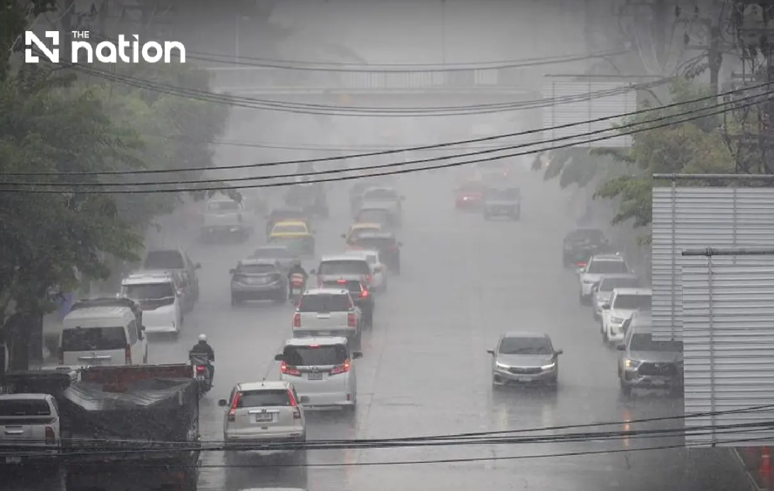
Thailand faces a critical weather period as the Thai Meteorological Department escalates its alert level over intensifying monsoon conditions expected to persist through Friday, August 21. The warning, issued Wednesday afternoon, represents the ninth such alert issued by authorities and underscores the serious nature of weather systems currently bearing down on the kingdom's most vulnerable regions. A combination of atmospheric factors—notably a monsoon trough sweeping across upper Thailand coupled with an unusually robust southwest monsoon circulation—has created conditions primed for significant precipitation and dangerous secondary weather phenomena.
The meteorological hazard extends well beyond simple rainfall, with authorities emphasizing that accumulated moisture from earlier showers combined with fresh torrential downpours creates compound risk. Flash flooding poses the most immediate danger, particularly in foothill settlements positioned above natural drainage channels and in depression areas where water concentrates rapidly. Residents in these geographic zones face the prospect of sudden inundation that can develop faster than communities can respond. The department has specifically cautioned those living near waterways and in low-lying settlements to maintain heightened vigilance and monitor official communications continuously throughout the forecast window.
Northern Thailand confronts some of the most severe conditions in this weather system. Eight provinces—Chiang Mai, Chiang Rai, Phayao, Lamphun, Sukhothai, Tak, Kamphaeng Phet and Phichit—face heavy rainfall expectations, while a second tier of seven provinces including Mae Hong Son, Lampang, Nan, Phrae, Uttaradit, Phitsanulok and Phetchabun are threatened with very heavy precipitation. The forecast calls for thunderstorm coverage across 80 percent of the region from Wednesday evening through Thursday evening, creating saturation conditions across an enormous geographic area. With minimum temperatures hovering between 22 and 27 degrees Celsius and maximum readings between 28 and 34 degrees, the heat will drive continued atmospheric instability and convection.
The northeastern plateau region faces similarly dire conditions, with thunderstorm coverage expected across 80 percent of the area. Twelve provinces including major population centers such as Nakhon Ratchasima, Khon Kaen and Ubon Ratchathani experience heavy rain forecasts, while eight additional provinces face threats of very heavy downpours. The combination of terrain characteristics—the Northeast's plateau geography channels runoff efficiently but also concentrates water in depressions and low areas—amplifies flood risks. Temperatures ranging from 22 to 25 degrees minimum and 27 to 32 degrees maximum will sustain the atmospheric conditions driving rainfall generation.
Central Thailand and the eastern regions face secondary but still significant impacts from the same weather system. The central zone will experience thunderstorms across 60 percent of its area, with six provinces at risk for heavy rain including Nakhon Sawan, Phra Nakhon Si Ayutthaya and Kanchanaburi. The eastern region will see 70 percent thunderstorm coverage, with Trat province specifically flagged for potential very heavy rainfall. Bangkok and surrounding provinces will witness thunderstorms across 60 percent of the metropolitan zone, though isolated rather than widespread heavy rain is currently anticipated, offering some relief to Thailand's capital and its vast urban population.
Maritime hazards compound the terrestrial weather risks, particularly in vulnerable coastal areas. The upper Andaman Sea and upper Gulf of Thailand face wave heights reaching two to three meters, with conditions deteriorating to above three meters during active thunderstorms. The meteorological department has specifically advised all small vessels operating in the upper Andaman and upper Gulf to remain ashore throughout the forecast period, acknowledging that maritime safety cannot be assured under these conditions. Larger commercial vessels have been advised to proceed with extreme caution and avoid developing thunderstorm cells. The lower Andaman Sea will experience somewhat less severe conditions with two-meter baseline waves increasing beyond two meters in stormy zones.
Southern Thailand's eastern coast presents a mosaic of risk levels depending on location. The region from Phetchaburi through Surat Thani will experience thunderstorms across 40 percent of the area, with temperatures ranging from 23 to 27 degrees minimum and 33 to 36 degrees maximum. From Surat Thani northward, southwesterly winds will reach 20 to 35 kilometers per hour with two-to-three-meter waves, while the region from Nakhon Si Thammarat southward experiences marginally lighter wind speeds but still heightened wave conditions during thunderstorms. This geographic variation reflects the complex interplay of monsoon flows across the peninsula.
Practical guidance issued by authorities emphasizes transportation precautions as essential during this forecast period. Motorists are strongly advised to avoid roads with histories of repeated flooding, particularly routes traversing low-lying areas where temporary inundation can establish itself with little warning. The three-day window demands careful journey planning and continuous monitoring of official forecasts and alerts. This advisory reflects the reality that flash flood formation often occurs suddenly and with insufficient time for warning dissemination, making pre-emptive avoidance the most effective safety strategy.
For Malaysian readers and Southeast Asian regional observers, this weather event carries broader significance. Thailand's vulnerability to monsoon-driven flooding during August reflects geographic and climatic patterns that affect the entire region, including Malaysia. The methodologies and early warning systems deployed by Thai authorities offer relevant insights for domestic weather monitoring and flood preparedness. Moreover, any significant flooding in Thailand's major population and economic centers carries potential ripple effects across cross-border trade and regional commerce. The intensity of this particular system, with very heavy rain concentrated in multiple population centers simultaneously, suggests authorities are correctly prioritizing public warning and preparedness messaging at this critical juncture.

