China's National Meteorological Centre has issued a red alert — the nation's most severe typhoon warning — as Typhoon Noul bears down on the southern coast. The announcement on Saturday evening signalled extraordinary concern among Chinese authorities about the magnitude of the approaching storm system, which ranks as the 12th typhoon of the current season. The timing and intensity of the warning underscores the potential threat facing millions of residents across multiple provinces in south and central China.
At the time of the alert, Typhoon Noul's centre positioned itself roughly 100 kilometres southeast of Huidong County in Huizhou City, Guangdong Province. The storm system demonstrated formidable power, with maximum sustained winds near its core reaching Force 14 — equivalent to approximately 150 kilometres per hour. This magnitude places the typhoon in the upper range of tropical cyclone intensity, capable of inflicting severe damage to infrastructure, agriculture, and coastal communities.
The National Meteorological Centre projected that Typhoon Noul would maintain a northwestward trajectory at approximately 20 kilometres per hour while simultaneously strengthening. This combination of sustained movement and intensification posed a compounded risk, as the system would reach peak strength while advancing toward populated coastal zones. Meteorologists anticipated that following landfall along Guangdong's shoreline, the typhoon would gradually reorient toward a north-northwestward heading and begin to weaken as it transitioned inland and encountered less favourable atmospheric conditions.
China's multi-tiered alert system reflects the nation's extensive experience managing tropical cyclones in its eastern and southern regions. The four-colour framework — red, orange, yellow, and blue — provides clear communication to the public and emergency responders about hazard severity. The red classification represents the apex of this hierarchy, triggered only when meteorologists assess that a typhoon poses an extreme and imminent threat to life and property. The decision to activate this level signalled that authorities viewed Typhoon Noul as one of the season's most dangerous systems.
Concurrent with the national observatory's red alert, Chinese emergency management authorities escalated their response protocols. The State Flood Control and Drought Relief Headquarters elevated Guangdong Province to Level III emergency status — a major escalation in operational readiness. The same body simultaneously activated Level IV flood emergency procedures for Jiangxi and Hunan provinces, demonstrating recognition that the typhoon's impacts would extend well beyond the immediate coastal impact zone. These preparations reflected understanding that heavy rainfall associated with typhoon systems frequently triggers cascading flood hazards across inland territories as moisture-laden air masses interact with topography and drainage systems.
For Malaysia and other Southeast Asian nations, typhoons originating in the northwest Pacific basin carry significant implications. While Typhoon Noul's primary threat focused on southern China, the regional atmospheric dynamics that generate such systems influence weather patterns across the broader region. Major tropical cyclones affecting China's coast can alter monsoon flows and precipitation patterns affecting neighbouring countries, including Malaysia. Understanding the trajectory and intensity of such storms helps Malaysian meteorological and disaster management authorities anticipate secondary weather effects and prepare accordingly.
The seasonal context of Typhoon Noul's occurrence matters significantly. As the 12th typhoon of the year, it reflects a relatively active typhoon season across the western Pacific. This intensity of tropical cyclone activity correlates with specific oceanic and atmospheric conditions — including sea surface temperatures, atmospheric instability, and steering wind patterns — that can persist for extended periods. A particularly active typhoon season in the western Pacific can occasionally influence broader Southeast Asian weather patterns, particularly during transitional monsoon periods.
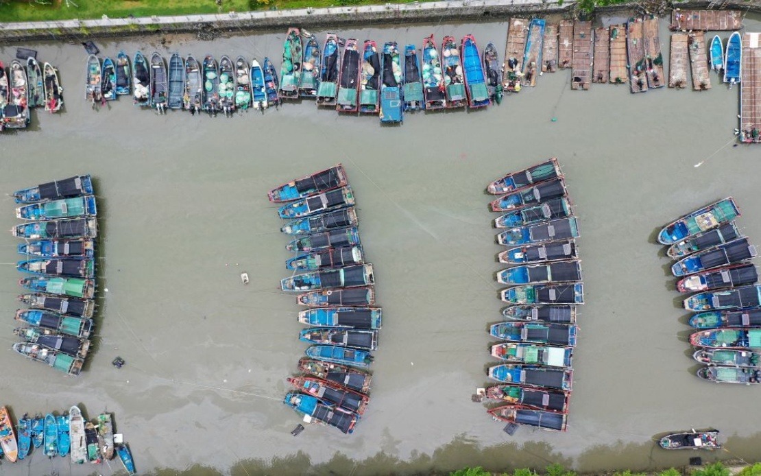
Ground-level preparedness measures would have commenced immediately following the red alert. Authorities in Guangdong typically implement evacuation procedures for vulnerable coastal populations, secure loose objects and temporary structures, reinforce flood defences, pre-position emergency supplies and personnel, and conduct briefings to ensure public understanding of expected impacts. Port authorities close harbours to maritime traffic, fishing vessels return to safe anchorage, and transportation networks implement speed restrictions or closures. These coordinated responses represent the outcome of decades of institutional learning regarding typhoon preparedness.
The intensity of governmental response to Typhoon Noul also reflects China's economic stakes in the Guangdong region. As one of the nation's most developed and densely populated provinces, and home to major port facilities and manufacturing hubs, the potential for significant economic disruption exists whenever major typhoons approach. Supply chain impacts can reverberate far beyond China's borders, affecting global commerce and manufacturing networks that depend on Guangdong's industrial output and logistical capabilities. For Malaysian businesses and traders with ties to southern Chinese operations, monitoring typhoon impacts remains commercially relevant.
The broader question of typhoon intensity and climate dynamics has attracted increasing scientific attention. While individual storms cannot be directly attributed to climate change, long-term trends in tropical cyclone intensity and patterns warrant careful observation. Rising sea surface temperatures in the western Pacific provide greater energy for storm development, potentially supporting stronger peak intensities. Understanding whether seasonal typhoon activity shows systematic changes remains an active area of climate research with implications for long-term infrastructure planning and coastal development strategies across the entire region.

