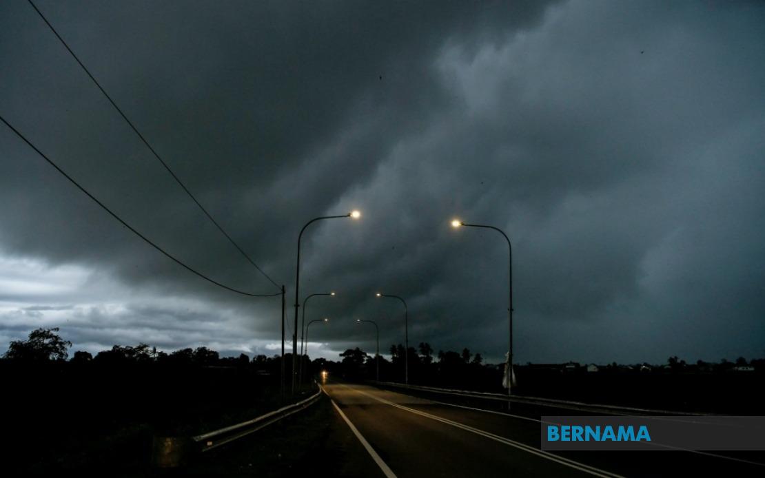
The Malaysian Meteorological Department has activated a significant weather alert system, warning residents across multiple regions to prepare for potentially hazardous atmospheric conditions. The alert, valid until 1 am on June 19, encompasses six states plus the federal territory of Labuan, signalling a widespread weather disturbance expected to impact the country during the evening and overnight hours.
In Peninsular Malaysia, the northern state of Kedah faces the greatest exposure, with three districts explicitly named in the warning: Padang Terap, Sik, and Baling. These areas, which experience the monsoon influence heavily, are particularly vulnerable to rapid weather deterioration when atmospheric moisture combines with thermal convection. Perak's Hulu Perak district, located inland along major river systems, has also been flagged as a concern zone, as these elevated terrain areas can channelise wind and intensify rainfall runoff.
Kelantan, situated on the east coast and historically prone to severe weather events, faces threats across five districts: Tumpat, Pasir Mas, Jeli, Tanah Merah, and Kuala Krai. The coastal and lowland areas among these divisions are particularly susceptible to thunderstorm activity during specific monsoon phases. Meanwhile, Pahang's Jerantut district, positioned in the state's interior, rounds out the Peninsular Malaysian coverage, representing a geographically diverse warning zone.
Sarawak's exposure to this weather system is notably extensive, spanning both coastal and interior divisions. Kuching, the state capital and largest urban centre, sits alongside smaller areas such as Serian and Samarahan in the southwestern region. The warning extends throughout the state's heartland, covering Sri Aman and the Betong area, as well as the central divisions of Sarikei, Sibu, and Kapit, which includes the Bukit Mabong locality. Coastal zones facing the South China Sea, including Bintulu and the northern divisions of Miri and Limbang, complete the Sarawakian alert zone. This broad coverage underscores the transnational nature of the weather system affecting Borneo.
Sabah's inclusion reflects the system's reach across the eastern portion of Malaysian Borneo. The warning encompasses the Interior division's Kuala Penyu area, the West Coast zone covering Putatan and Ranau, and Sandakan division's districts of Telupid and Beluran. Federal territory Labuan, positioned off Sabah's coast in the Brunei Bay region, faces similar severe weather risks, completing the geographic scope of this meteorological alert.
Thunderstorm warnings issued by MetMalaysia represent a serious public safety concern, as such weather systems bring multiple hazards simultaneously. Heavy rainfall associated with thunderstorms can trigger flash flooding in low-lying areas and along river systems, a particular risk in Borneo's densely forested terrain where saturated ground and limited drainage capacity compound flooding risks. Strong winds accompanying these storms endanger structures, vegetation, and outdoor activities, while lightning poses direct threats to human safety and can ignite fires in certain conditions.
The timing of this alert—extending into the overnight hours until 1 am—carries additional implications for public safety. Night-time weather events reduce visibility for motorists and make emergency response operations more challenging. Communities in affected areas would be wise to secure loose outdoor items, ensure drainage channels remain clear, and stay informed through official MetMalaysia updates or local authority announcements throughout the warning period.
For residents and businesses across these regions, the warning serves as advance notice to implement precautionary measures. Industrial facilities and construction sites should assess their preparedness for high winds and lightning strikes, while schools and public facilities may need to consider adjusting schedules or operations if conditions deteriorate significantly. Agricultural stakeholders, particularly those engaged in horticulture or aquaculture operations in flood-prone zones, should monitor the situation closely.
MetMalaysia's decision to issue this multi-state alert reflects the organisation's assessment that atmospheric conditions justify coordinated public awareness. The breadth of the warning across Peninsular Malaysia, Sarawak, and Sabah indicates a weather system of considerable geographic extent, likely driven by monsoon circulation patterns or tropical convective processes typical of Malaysia's equatorial and tropical maritime climate. Such system-wide alerts typically emerge during transitional monsoon periods or when localised heating combines with sufficient atmospheric moisture to generate widespread thunderstorm development.
Residents in warned areas should remain alert and monitor weather developments closely. MetMalaysia typically issues updated forecasts and warnings as situations evolve, and the public is encouraged to check official channels for the most current information. While thunderstorms are a normal component of Malaysia's climate, the organisation's issuance of this warning indicates conditions sufficiently severe to warrant heightened preparedness and caution across the affected population centres and districts.


%22%2F%3E%3C%2Fpattern%3E%3C%2Fdefs%3E%3Crect%20width%3D%22100%25%22%20height%3D%22100%25%22%20fill%3D%22url(%23ph2hy9vg)%22%2F%3E%3Crect%20width%3D%22100%25%22%20height%3D%22100%25%22%20fill%3D%22url(%23ph2hy9vp)%22%2F%3E%3Ctext%20x%3D%2250%25%22%20y%3D%2250%25%22%20text-anchor%3D%22middle%22%20dominant-baseline%3D%22central%22%20fill%3D%22rgba(255%2C255%2C255%2C0.95)%22%20font-family%3D%22Georgia%2C%20'Times%20New%20Roman'%2C%20serif%22%20font-weight%3D%22700%22%20font-size%3D%22272%22%20letter-spacing%3D%22-0.02em%22%3EAnwar%3C%2Ftext%3E%3C%2Fsvg%3E)