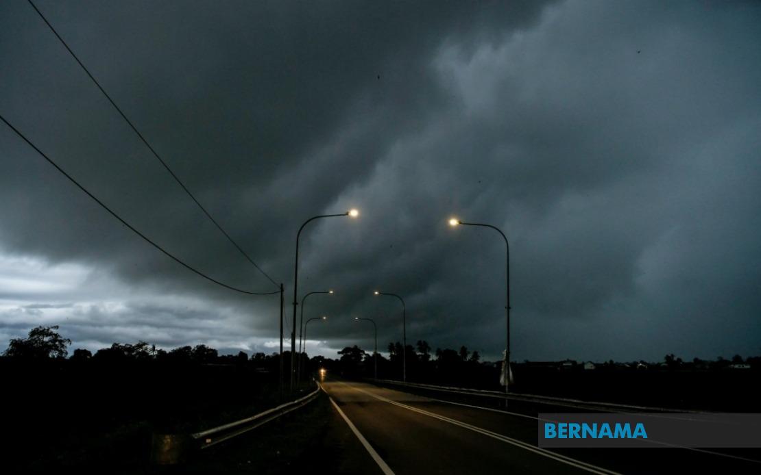
The Malaysian Meteorological Department has activated severe weather alerts spanning much of the northern peninsula and East Malaysia, with conditions expected to persist until 9 pm on June 18. The advisory encompasses entire regions and specific districts across a broad geographical swath, reflecting an unusually widespread atmospheric disturbance affecting the country's populated heartland as well as remote interior zones.
The warning blankets the entirety of Perlis, traditionally one of Malaysia's most vulnerable areas during the southwest monsoon transition period. Across the border in Kedah, multiple districts face the threat, specifically Langkawi—Malaysia's premier island destination—alongside Kubang Pasu, Kota Setar, Pokok Sena, Padang Terap, Sik and Baling. This concentration in the northwestern peninsula reflects how maritime and orographic influences converge to create volatile atmospheric conditions in this region during unstable weather patterns.
Perak's industrial heartland and central highlands lie directly in the path of the disturbance. The affected areas include Kerian, Larut, Matang and Selama in the coastal northwest, as well as Kuala Kangsar, Kinta and Kampar in the state's densely populated and economically significant interior. These zones encompass major urban centres and tin mining regions where drainage infrastructure must handle sudden downpours, making such warnings operationally critical for local authorities and businesses.
The alert extends through the central peninsula's interior zones. Cameron Highlands, a major hill station and agricultural centre producing tea and vegetables, falls within the warning area, as do Bentong, Bera and Rompin in Pahang—regions that experience rapid runoff during heavy precipitation events. In Selangor, Hulu Langat, which includes the capital's eastern suburban sprawl and catchment areas feeding urban water supplies, has been flagged for potentially hazardous conditions.
Negeri Sembilan's Jelebu and Jempol districts, located in the state's interior plateau region, have also been included in the alert, while Johor's southern territories of Segamat, Kluang and Mersing face similar threats. These southern districts represent the transition zone between peninsular Malaysia and East Malaysia, areas that often experience distinct weather patterns tied to maritime influences and local topography.
Sarawak's warning encompasses an expansive list of divisions reflecting the state's geographical complexity. Kuching, the capital and commercial hub, faces potential storms in its Bau and main administrative districts, while surrounding Serian and Samarahan regions including Asajaya have been flagged. The alert extends inland through Sarikei's Meradong area, the riverside town of Sibu, and Mukah's coastal Tanjung Manis zone. The upper Rajang River valley areas of Kapit, including Song district, alongside Bintulu's interior zones of Tatau and Sebauh, round out the peninsular division alerts. Miri's Marudi district and Limbang complete Sarawak's affected regions, meaning virtually the entire state faces some degree of weather risk.
Sabah similarly experiences comprehensive coverage under the warning system. The interior plateau region encompassing Sipitang, Kuala Penyu, Beaufort and Tambunan—all characterized by rugged terrain and limited drainage infrastructure—faces the advisory. The west coast districts bordering the South China Sea, plus Sandakan division's Tongod and Kinabatangan areas in the northeast, have also been placed on alert. This pattern suggests a weather system of considerable vertical extent affecting the entire Borneo landmass.
The scope of this alert—spanning from Perlis in the far north to Sabah and Sarawak in East Malaysia—indicates atmospheric conditions of unusual intensity and spatial scale. Such widespread thunderstorm warnings typically accompany equatorial convergence zones or significant pressure troughs, systems capable of triggering flash flooding, landslides and power disruptions across affected areas. For residents and businesses in these regions, the advisory signals a period requiring heightened vigilance regarding outdoor activities, travel and water management.
The evening deadline of 9 pm provides a temporal boundary for when conditions are expected to abate, though residual effects may linger beyond the official warning period. MetMalaysia's decision to specify affected districts rather than issuing blanket state-level alerts reflects the variable nature of thunderstorms, allowing residents in non-flagged areas to maintain normal operations while those in identified zones take appropriate precautions. Travellers planning movement through these regions should monitor weather updates closely, as sudden downpours and reduced visibility pose significant hazards on highways and secondary roads.


%22%2F%3E%3C%2Fpattern%3E%3C%2Fdefs%3E%3Crect%20width%3D%22100%25%22%20height%3D%22100%25%22%20fill%3D%22url(%23ph2hy9vg)%22%2F%3E%3Crect%20width%3D%22100%25%22%20height%3D%22100%25%22%20fill%3D%22url(%23ph2hy9vp)%22%2F%3E%3Ctext%20x%3D%2250%25%22%20y%3D%2250%25%22%20text-anchor%3D%22middle%22%20dominant-baseline%3D%22central%22%20fill%3D%22rgba(255%2C255%2C255%2C0.95)%22%20font-family%3D%22Georgia%2C%20'Times%20New%20Roman'%2C%20serif%22%20font-weight%3D%22700%22%20font-size%3D%22272%22%20letter-spacing%3D%22-0.02em%22%3EAnwar%3C%2Ftext%3E%3C%2Fsvg%3E)